New Dawn housing development site, Church Road, Cheltenham
Introduction
The photograph on this page of New Dawn housing development site, Church Road, Cheltenham by Jaggery as part of the Geograph project.
The Geograph project started in 2005 with the aim of publishing, organising and preserving representative images for every square kilometre of Great Britain, Ireland and the Isle of Man.

There are currently over 7.5m images from over 14,400 individuals and you can help contribute to the project by visiting https://www.geograph.org.uk
New Dawn housing development site, Church Road, Cheltenham
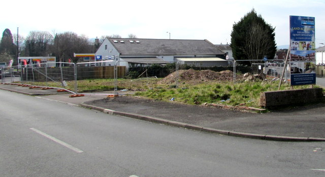
Image: © Jaggery Taken: 3 Apr 2016
In early April 2016, the site is fenced off. A pile of rubble has replaced the house shown here in an August 2012 Google Earth Street View. The New Dawn notice on the right shows LAND ACQUIRED FOR ANOTHER QUALITY DEVELOPMENT.
Images are licensed for reuse under creativecommons.org/licenses/by-sa/2.0
Image Location


Leaflet Map data © OpenStreetMap
Latitude
51.895511
Longitude
-2.105458