Disused railway near Sandhill 2
Introduction
The photograph on this page of Disused railway near Sandhill 2 by Andy Gryce as part of the Geograph project.
The Geograph project started in 2005 with the aim of publishing, organising and preserving representative images for every square kilometre of Great Britain, Ireland and the Isle of Man.

There are currently over 7.5m images from over 14,400 individuals and you can help contribute to the project by visiting https://www.geograph.org.uk
Disused railway near Sandhill 2
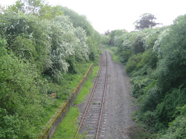
Image: © Andy Gryce Taken: 12 May 2007
This disused railway line looking south-west from a road bridge in the opposite direction to Image is all that remains of the Oxford to Bletchley railway. The single track is hardly overgrown on this side of the bridge. From here it first passes the site of Claydon station 2km away, and then 1.5km further on, south of Steeple Claydon, the track doubles and is still in use, see Image
Images are licensed for reuse under creativecommons.org/licenses/by-sa/2.0
Image Location
Latitude
51.939031
Longitude
-0.94562