Under Gillity Bridge
Introduction
The photograph on this page of Under Gillity Bridge by Stephen McKay as part of the Geograph project.
The Geograph project started in 2005 with the aim of publishing, organising and preserving representative images for every square kilometre of Great Britain, Ireland and the Isle of Man.

There are currently over 7.5m images from over 14,400 individuals and you can help contribute to the project by visiting https://www.geograph.org.uk
Under Gillity Bridge
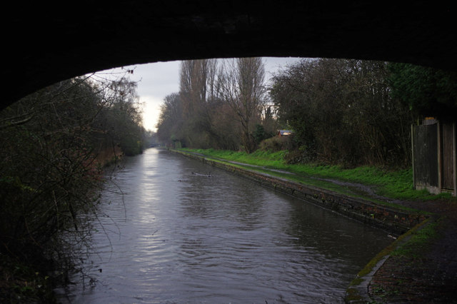
Image: © Stephen McKay Taken: 4 Apr 2016
The Rushall Canal was not built until 1847 by which time technology had advanced so that canals no longer needed to wind along the contours but could be built mostly dead straight using cuttings and embankments. Paradoxically, modern leisure boaters tend to find this makes for less interesting routes but must have been much preferred by the commercial boatmen of old. This is the scene at Gillity Bridge which is in fact between locks 2 and 3 on the Rushall Flight, but they are well separated.
Images are licensed for reuse under creativecommons.org/licenses/by-sa/2.0
Image Location
Latitude
52.574947
Longitude
-1.948901