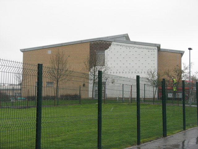
Oxgangs Primary revisited
Introduction
The photograph on this page of Oxgangs Primary revisited by M J Richardson as part of the Geograph project.
The Geograph project started in 2005 with the aim of publishing, organising and preserving representative images for every square kilometre of Great Britain, Ireland and the Isle of Man.
There are currently over 7.5m images from over 14,400 individuals and you can help contribute to the project by visiting https://www.geograph.org.uk

Image: © M J Richardson Taken: 12 Apr 2016
Just over two months after part of the gable collapsed during Storm Gertrude Image, and four days after Edinburgh Council announced that 17 schools would not be reopening after the Easter break and would be closed indefinitely. Faults had been found or suspected in these schools, all built at the same time, by the same contractor, as part of the same Public Private Partnership. As a consequence about 8000 pupils are unable to go to school, causing problems for parents and worries for pupils soon to sit exams.

