Bridge No 2, Wendover Arm - at New Mill, Tring
Introduction
The photograph on this page of Bridge No 2, Wendover Arm - at New Mill, Tring by Chris Reynolds as part of the Geograph project.
The Geograph project started in 2005 with the aim of publishing, organising and preserving representative images for every square kilometre of Great Britain, Ireland and the Isle of Man.

There are currently over 7.5m images from over 14,400 individuals and you can help contribute to the project by visiting https://www.geograph.org.uk
Bridge No 2, Wendover Arm - at New Mill, Tring
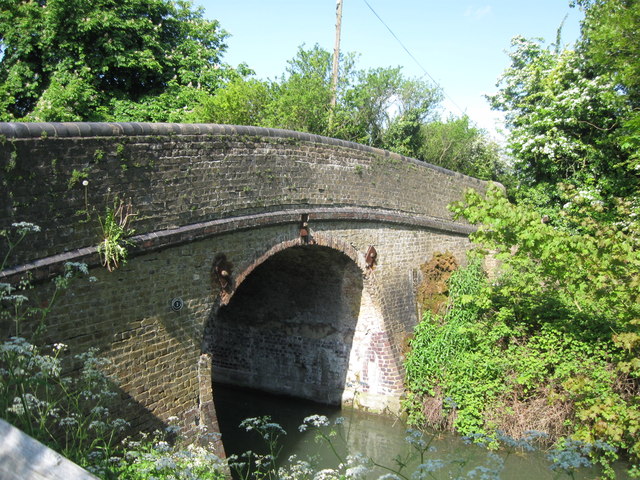
Image: © Chris Reynolds Taken: 10 May 2009
This bridge is over 200 years old and is a narrow hump-backed bridge with a steep approach - especially on the North side. This means that as your approach the bridge along the road you cannot see if another vehicle is approaching from the other side until you get very close. The canal tow path switches from one side of the canal to the other at this point. See Also Image
Images are licensed for reuse under creativecommons.org/licenses/by-sa/2.0
Image Location
Latitude
51.809089
Longitude
-0.661016