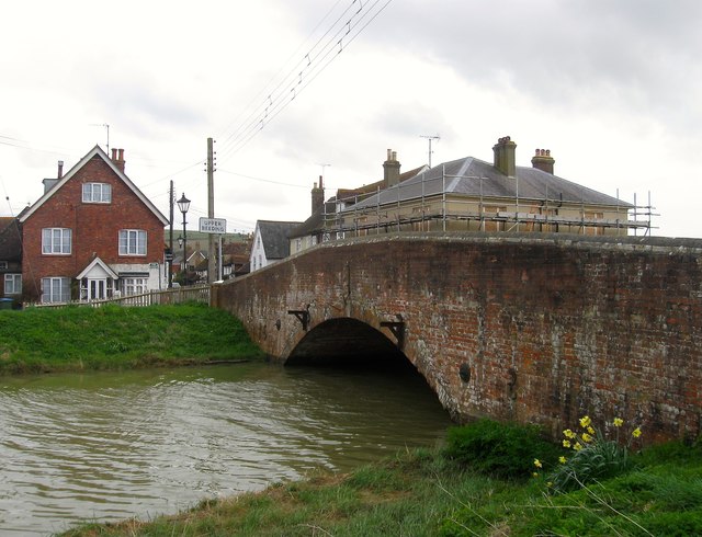
Beeding Bridge
Introduction
The photograph on this page of Beeding Bridge by Simon Carey as part of the Geograph project.
The Geograph project started in 2005 with the aim of publishing, organising and preserving representative images for every square kilometre of Great Britain, Ireland and the Isle of Man.
There are currently over 7.5m images from over 14,400 individuals and you can help contribute to the project by visiting https://www.geograph.org.uk

Image: © Simon Carey Taken: 9 Apr 2016
A view of the north side of bridge at high tide where it crosses the River Adur at the point where Bramber becomes Upper Beeding. A bridge appears to have been in existence here by the end of the 11th century and was probably built by the De Braose family who owned nearby Bramber Castle. The current stone bridge dates from around 1785 when it replaced a former timber bridge and was built by Magdalen College, Oxford who had acquired ownership from Sele Priory at the Reformation. The north side was widened in 1845 and the steel footbridge on the southern side added in 1926. Bridge House is on the left with the top floor of scaffold clad former Bridge Inn to the right.

