East Ferry Road, Cupitt Town, London, E14
Introduction
The photograph on this page of East Ferry Road, Cupitt Town, London, E14 by David Hallam-Jones as part of the Geograph project.
The Geograph project started in 2005 with the aim of publishing, organising and preserving representative images for every square kilometre of Great Britain, Ireland and the Isle of Man.

There are currently over 7.5m images from over 14,400 individuals and you can help contribute to the project by visiting https://www.geograph.org.uk
East Ferry Road, Cupitt Town, London, E14
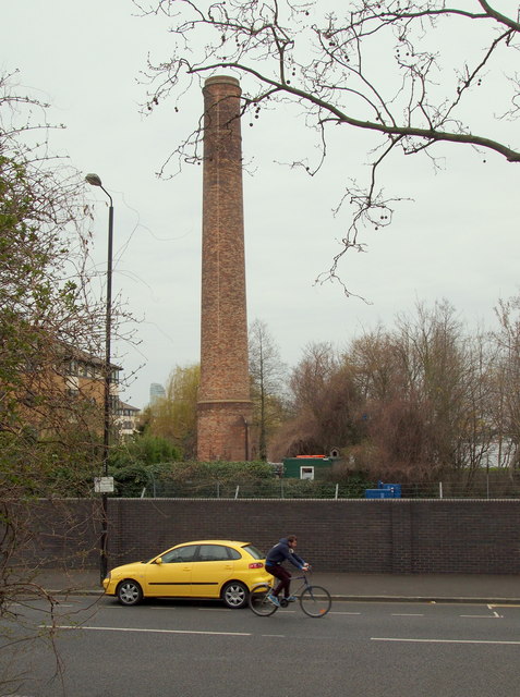
Image: © David Hallam-Jones Taken: 2 Apr 2016
Immediately behind the photographer is an access point to/from the Mudchute City Farm and Urban Park site. The base of this preserved redundant chimney is situated at the side of a service road on the edge of a new-build residential development on Undine Road, on the other side of this wall. 100 metres or so behind the chimney lies the Outer Millwall Dock. The fir tree given annually to the people of London by the city of Oslo as a token of gratitude for help received during WWII was, in the past, shipped to Millwall Docks. Its transportation was conducted free of charge by the Fred Olsen Line, a company with strong links to the Isle of Dogs. For example, Canary Wharf was named at this company’s request in the 1930s, and still later, they operated a cruise liner terminal in Millwall Docks.
Images are licensed for reuse under creativecommons.org/licenses/by-sa/2.0
Image Location


Leaflet Map data © OpenStreetMap
Latitude
51.493401
Longitude
-0.014837