Church of All Saints, Houghton Conquest
Introduction
The photograph on this page of Church of All Saints, Houghton Conquest by pam fray as part of the Geograph project.
The Geograph project started in 2005 with the aim of publishing, organising and preserving representative images for every square kilometre of Great Britain, Ireland and the Isle of Man.

There are currently over 7.5m images from over 14,400 individuals and you can help contribute to the project by visiting https://www.geograph.org.uk
Church of All Saints, Houghton Conquest
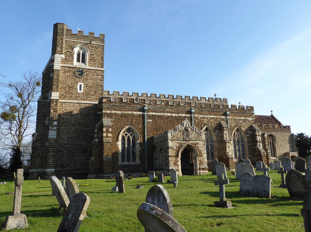
Image: © pam fray Taken: 5 Apr 2016
A 14th century Grade I listed building, the largest parish church in Bedfordshire. The name of the village originated from the Conquest family who held a manor and lands in the area from the 13th to the 18th century. Houghton is pronounced "how-ton".
Images are licensed for reuse under creativecommons.org/licenses/by-sa/2.0
Image Location
Latitude
52.06134
Longitude
-0.479316