Lockside turbine housing, Dudbridge, Stroudwater Navigation
Introduction
The photograph on this page of Lockside turbine housing, Dudbridge, Stroudwater Navigation by Christine Johnstone as part of the Geograph project.
The Geograph project started in 2005 with the aim of publishing, organising and preserving representative images for every square kilometre of Great Britain, Ireland and the Isle of Man.

There are currently over 7.5m images from over 14,400 individuals and you can help contribute to the project by visiting https://www.geograph.org.uk
Lockside turbine housing, Dudbridge, Stroudwater Navigation
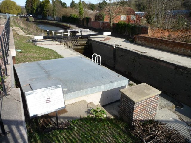
Image: © Christine Johnstone Taken: 28 Mar 2016
Part of the Dudbridge Locks hydroelectricity scheme, using water fed into the canal from Painswick Brook and Slad Brook. This is the lower lock of two, also known as Franklins or Dudbridge.
Images are licensed for reuse under creativecommons.org/licenses/by-sa/2.0
Image Location
Latitude
51.742289
Longitude
-2.239068