Trafalgar Square
Introduction
The photograph on this page of Trafalgar Square by David Dixon as part of the Geograph project.
The Geograph project started in 2005 with the aim of publishing, organising and preserving representative images for every square kilometre of Great Britain, Ireland and the Isle of Man.

There are currently over 7.5m images from over 14,400 individuals and you can help contribute to the project by visiting https://www.geograph.org.uk
Trafalgar Square
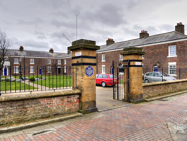
Image: © David Dixon Taken: 24 Mar 2016
These Alms Houses were built in the 1840s as accommodation for retired merchant seamen. They are named after Lord Nelson’s famous victory in 1805. they are Grade II-listed as a group (English heritage List Entry Number: 1207071 http://www.heritagegateway.org.uk/Gateway/Results_Single.aspx?uid=1207071&resourceID=5 Heritage Gateway). The forecourt wall and the lamp standard in the centre of the square are separately listed, also at grade II http://www.heritagegateway.org.uk/Gateway/Results.aspx .
Images are licensed for reuse under creativecommons.org/licenses/by-sa/2.0
Image Location
Latitude
54.908046
Longitude
-1.367056