Church of Holy Trinity
Introduction
The photograph on this page of Church of Holy Trinity by David Dixon as part of the Geograph project.
The Geograph project started in 2005 with the aim of publishing, organising and preserving representative images for every square kilometre of Great Britain, Ireland and the Isle of Man.

There are currently over 7.5m images from over 14,400 individuals and you can help contribute to the project by visiting https://www.geograph.org.uk
Church of Holy Trinity
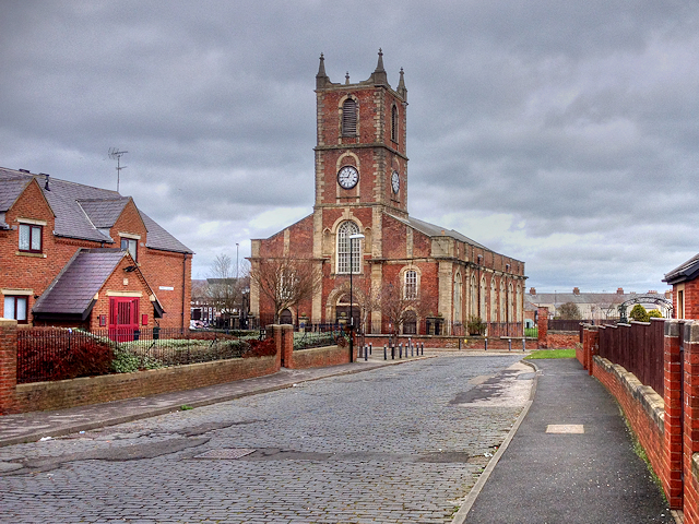
Image: © David Dixon Taken: 24 Mar 2016
Holy Trinity Church was opened in 1719 as the church for the newly created Parish of Sunderland and is one of the oldest buildings in the East End of Sunderland. Once at the heart of the community centred on the port, the church was closed in 1988 because of a dwindling congregation and the need for expensive repairs (http://twsitelines.info/SMR/4421 Tyne and Wear HER(4421)). It is now in the care of the Churches Conservation Trust. The church is a Grade I listed building (English Heritage List Entry Number: 1208056 http://www.heritagegateway.org.uk/Gateway/Results_Single.aspx?uid=1208056&resourceID=5 Heritage Gateway). See also See Image]
Images are licensed for reuse under creativecommons.org/licenses/by-sa/2.0
Image Location
Latitude
54.907697
Longitude
-1.369089