Gated footpath on Esplanade, Rock Ferry
Introduction
The photograph on this page of Gated footpath on Esplanade, Rock Ferry by John S Turner as part of the Geograph project.
The Geograph project started in 2005 with the aim of publishing, organising and preserving representative images for every square kilometre of Great Britain, Ireland and the Isle of Man.

There are currently over 7.5m images from over 14,400 individuals and you can help contribute to the project by visiting https://www.geograph.org.uk
Gated footpath on Esplanade, Rock Ferry
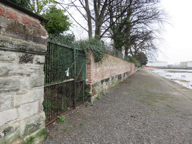
Image: © John S Turner Taken: 21 Mar 2016
The gated footpath on the left links Esplanade with Rock Park Road above, however, the gate is locked and there is a pile of rubbish of all sorts behind the gate. There is an Ordnance Survey bench mark on the sandstone wall below the modern brickwork - Image
Images are licensed for reuse under creativecommons.org/licenses/by-sa/2.0
Image Location
Latitude
53.371889
Longitude
-2.999611