St. Mildred's church and presbytery, Minster-in-Thanet
Introduction
The photograph on this page of St. Mildred's church and presbytery, Minster-in-Thanet by pam fray as part of the Geograph project.
The Geograph project started in 2005 with the aim of publishing, organising and preserving representative images for every square kilometre of Great Britain, Ireland and the Isle of Man.

There are currently over 7.5m images from over 14,400 individuals and you can help contribute to the project by visiting https://www.geograph.org.uk
St. Mildred's church and presbytery, Minster-in-Thanet
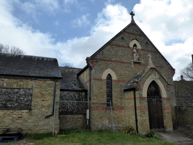
Image: © pam fray Taken: 27 Mar 2016
Situated in St. Mildred's Road. The church has been closed for some time and permission to demolish it and build houses on the site was denied in 2010. The site is now being cleared. It has also been necessary to clear Japanese knotweed from the grounds.
Images are licensed for reuse under creativecommons.org/licenses/by-sa/2.0
Image Location
Latitude
51.331403
Longitude
1.314047