High Wycombe
Introduction
The photograph on this page of High Wycombe by Peter Trimming as part of the Geograph project.
The Geograph project started in 2005 with the aim of publishing, organising and preserving representative images for every square kilometre of Great Britain, Ireland and the Isle of Man.

There are currently over 7.5m images from over 14,400 individuals and you can help contribute to the project by visiting https://www.geograph.org.uk
High Wycombe
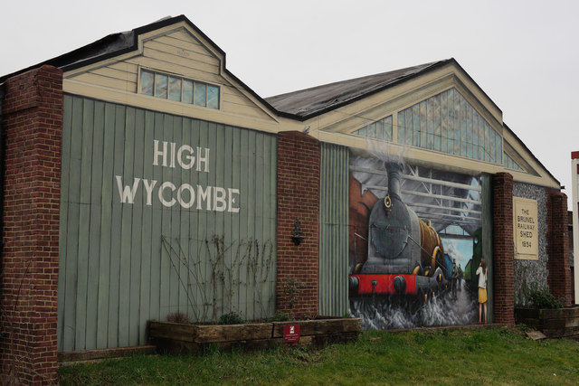
Image: © Peter Trimming Taken: 23 Mar 2016
The original terminus station was built in 1854 after an original design by I.K. Brunel. This building remained as a station in use until 1864 when it became a goods shed. The Grade II Listed building now sports an 18-metre trompe l’oeil mural showing Isambard Kingdom Brunel inspecting a train. Created by artist Dan Wilson, in 2014.
Images are licensed for reuse under creativecommons.org/licenses/by-sa/2.0
Image Location


Leaflet Map data © OpenStreetMap
Latitude
51.629572
Longitude
-0.746783