Flood mark on house in Back Street
Introduction
The photograph on this page of Flood mark on house in Back Street by Jonathan Thacker as part of the Geograph project.
The Geograph project started in 2005 with the aim of publishing, organising and preserving representative images for every square kilometre of Great Britain, Ireland and the Isle of Man.

There are currently over 7.5m images from over 14,400 individuals and you can help contribute to the project by visiting https://www.geograph.org.uk
Flood mark on house in Back Street
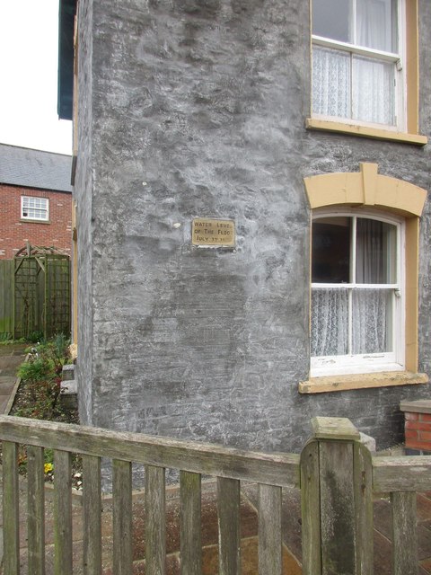
Image: © Jonathan Thacker Taken: 24 Mar 2016
Langtoft sits at the point where three narrow valleys come together. It has been devastated by floods on several occasions. This plaque marks the level reached on 3rd July 1892 when the water was recorded as seven and a half feet deep.
Images are licensed for reuse under creativecommons.org/licenses/by-sa/2.0
Image Location
Latitude
54.087824
Longitude
-0.456034