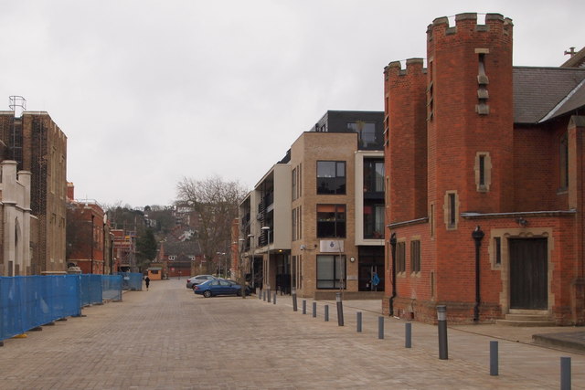
Ashmore Road, Woolwich, London SE18
Introduction
The photograph on this page of Ashmore Road, Woolwich, London SE18 by David Hallam-Jones as part of the Geograph project.
The Geograph project started in 2005 with the aim of publishing, organising and preserving representative images for every square kilometre of Great Britain, Ireland and the Isle of Man.
There are currently over 7.5m images from over 14,400 individuals and you can help contribute to the project by visiting https://www.geograph.org.uk

Image: © David Hallam-Jones Taken: 20 Mar 2016
Redevelopment of the former Military Academy buildings appears to be continuing, as evidenced by the blue plastic security fencing on the left. A security person's hut is also visible at the distant east gate, a gate that provides controlled access to this residential site from Red Lion Lane. The former Garrison Church (a.k.a. the academy chapel) of St Michael and All Angels (built 1902-04) - used by former officer cadets - is the red brick building on the right. Beyond the chapel is a block of apartments built in 2012 or 2013. .

