Tannadice Street
Introduction
The photograph on this page of Tannadice Street by Paul McIlroy as part of the Geograph project.
The Geograph project started in 2005 with the aim of publishing, organising and preserving representative images for every square kilometre of Great Britain, Ireland and the Isle of Man.

There are currently over 7.5m images from over 14,400 individuals and you can help contribute to the project by visiting https://www.geograph.org.uk
Tannadice Street
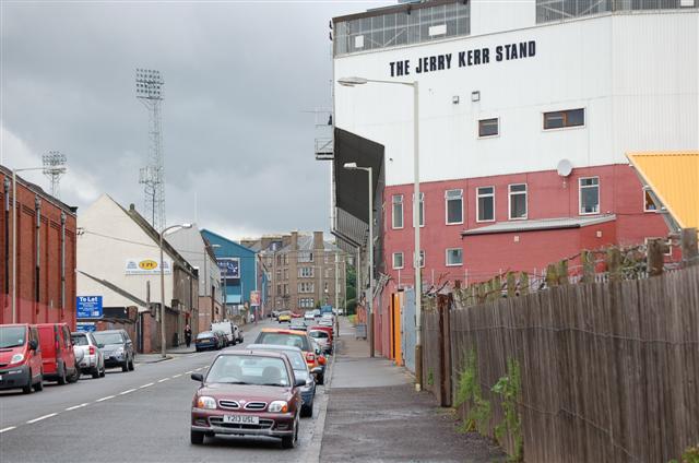
Image: © Paul McIlroy Taken: 6 Jul 2007
The nearest neighbours in British senior football are to be found here on Tannadice Street in Dundee. Tannadice Park, home to Dundee United is on the right of the picture, and Dens Park where Dundee FC play their home games can be seen at the top of the street.
Images are licensed for reuse under creativecommons.org/licenses/by-sa/2.0
Image Location
Latitude
56.474428
Longitude
-2.971046