Charnwood Street
Introduction
The photograph on this page of Charnwood Street by Alan Walker as part of the Geograph project.
The Geograph project started in 2005 with the aim of publishing, organising and preserving representative images for every square kilometre of Great Britain, Ireland and the Isle of Man.

There are currently over 7.5m images from over 14,400 individuals and you can help contribute to the project by visiting https://www.geograph.org.uk
Charnwood Street
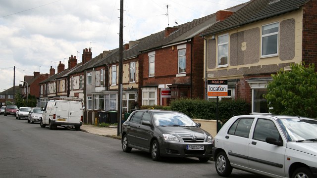
Image: © Alan Walker Taken: 29 Jun 2007
This south-easterly facing photograph of Charnwood Street (a cul-de-sac) is looking along a row of small Image built during the first two decades of the twentieth century. Ahead, at the end of the street, is its junction with Image At the other end of the street, behind the viewpoint, the street terminates in open land with a cycle/footpath route and a recreation ground. For another photograph of Charnwood Street, taken from a few metres behind this viewpoint and looking straight along the roadway toward the end of the street, click here: Image For another photograph of Charnwood Street, taken from the same viewpoint but looking in the opposite direction, click here: Image
Images are licensed for reuse under creativecommons.org/licenses/by-sa/2.0
Image Location
Latitude
53.121149
Longitude
-1.282129