Low Hall, Horsforth, Leeds
Introduction
The photograph on this page of Low Hall, Horsforth, Leeds by Mark Stevenson as part of the Geograph project.
The Geograph project started in 2005 with the aim of publishing, organising and preserving representative images for every square kilometre of Great Britain, Ireland and the Isle of Man.

There are currently over 7.5m images from over 14,400 individuals and you can help contribute to the project by visiting https://www.geograph.org.uk
Low Hall, Horsforth, Leeds
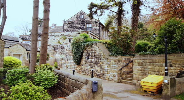
Image: © Mark Stevenson Taken: 27 Apr 2014
Low Hall (also known as Calverley Old Hall) was the ancient seat of the Calverley family, who had been prominent and wealthy local landowners since early medieval times. The estate passed to the Stanhopes after the Calverleys relocated to Esholt Hall in the 17th century. Low Hall is thought to be one of the best preserved medieval manor houses in West Yorkshire. The building’s escaped Victorian ‘modernisation’ as a grand villa, and remains true to its medieval form. The oldest part of the structure is the ‘Solar’ with its gable end facing into Low Hall Road, and dates from around 1380.
Images are licensed for reuse under creativecommons.org/licenses/by-sa/2.0
Image Location


Leaflet Map data © OpenStreetMap
Latitude
53.833017
Longitude
-1.66371