Currock Methodist Church being converted to flats
Introduction
The photograph on this page of Currock Methodist Church being converted to flats by Rose and Trev Clough as part of the Geograph project.
The Geograph project started in 2005 with the aim of publishing, organising and preserving representative images for every square kilometre of Great Britain, Ireland and the Isle of Man.

There are currently over 7.5m images from over 14,400 individuals and you can help contribute to the project by visiting https://www.geograph.org.uk
Currock Methodist Church being converted to flats
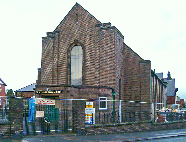
Image: © Rose and Trev Clough Taken: 28 Dec 2007
The church closed in 2006 - a dwindling congregation had made it unviable. The redevelopment, containing 14 flats, is now called Methodist Court. This part of the building dates from the 1930s. It was an extension to the original church built in 1908, which then became the church hall. For more historical information, see http://www.mywesleyanmethodists.org.uk/page/carlisle_currock_road_wm_chapel_cumberland .
Images are licensed for reuse under creativecommons.org/licenses/by-sa/2.0
Image Location
Latitude
54.879339
Longitude
-2.931683