
The Plough at Plumpton
Introduction
The photograph on this page of The Plough at Plumpton by David Gibbs as part of the Geograph project.
The Geograph project started in 2005 with the aim of publishing, organising and preserving representative images for every square kilometre of Great Britain, Ireland and the Isle of Man.

There are currently over 7.5m images from over 14,400 individuals and you can help contribute to the project by visiting https://www.geograph.org.uk
The Plough at Plumpton
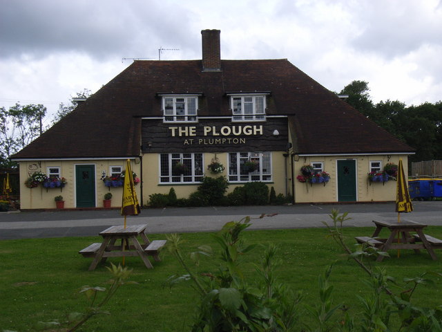
Image: © David Gibbs Taken: 28 Jun 2007
Face-on view of The Plough at Plumpton - Harvey’s Beers. Arguably, most people say that this pub is at Plumpton Green (which is about 1 mile to the south) rather than Plumpton which is about 3 miles to the south. Built in 1952, this pub replaced the earlier Plough that was demolished during the war because it was at the end of the wartime airfield. The site of the original Plough is at approximately TQ 359 150 and is now a yard for road materials. Next to the pub there is a memorial to the Polish airmen that were stationed at the airfield, which is at Bowers Farm about one mile to the north. The airstrip has been a host to two air shows recently which saw many cherished aircraft landing on the grass.
Images are licensed for reuse under creativecommons.org/licenses/by-sa/2.0
Image Location

Latitude
50.946285
Longitude
-0.058878