Bridge Over Barlewan Burn
Introduction
The photograph on this page of Bridge Over Barlewan Burn by Mary and Angus Hogg as part of the Geograph project.
The Geograph project started in 2005 with the aim of publishing, organising and preserving representative images for every square kilometre of Great Britain, Ireland and the Isle of Man.

There are currently over 7.5m images from over 14,400 individuals and you can help contribute to the project by visiting https://www.geograph.org.uk
Bridge Over Barlewan Burn
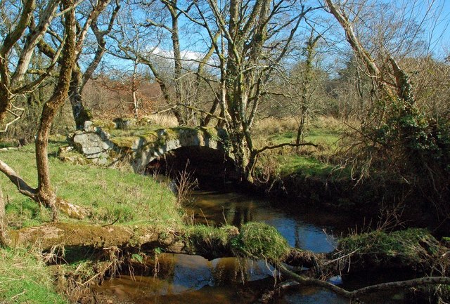
Image: © Mary and Angus Hogg Taken: 15 Mar 2016
There used to be a footpath from the B7023 crossing Barlewan Burn by this lovely little stone bridge but the speed of modern road traffic would make it dangerous to use nowadays. The existence of such a substantial bridge is consistent with the former local industries. There was a water-driven mill just upstream from here and the Burn was straightened by unemployed weavers from the nearby village of Crosshill after the end of the Napoleonic Wars to supply the lade for the old corn mill at Baird's Mill.
Images are licensed for reuse under creativecommons.org/licenses/by-sa/2.0
Image Location
Latitude
55.338807
Longitude
-4.64904