Saunderton church
Introduction
The photograph on this page of Saunderton church by Mark Percy as part of the Geograph project.
The Geograph project started in 2005 with the aim of publishing, organising and preserving representative images for every square kilometre of Great Britain, Ireland and the Isle of Man.

There are currently over 7.5m images from over 14,400 individuals and you can help contribute to the project by visiting https://www.geograph.org.uk
Saunderton church
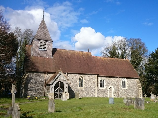
Image: © Mark Percy Taken: 4 Mar 2016
Originally, Saunderton had two manors and two churches. However, St Nicholas' church fell into decay and was demolished in 1452, while the remaining church, St Mary's, dating back to 1227, became known as St Mary & St Nicholas. It is a Grade II listed building, built on the site of a Roman villa. In 1886 the outer walls began to lean inwards, so most of the building was demolished and rebuilt using, wherever possible, the original materials. As a result much remains of the old structure and fittings.
Images are licensed for reuse under creativecommons.org/licenses/by-sa/2.0
Image Location
Latitude
51.710118
Longitude
-0.85036