Rhyne Drove
Introduction
The photograph on this page of Rhyne Drove by Derek Harper as part of the Geograph project.
The Geograph project started in 2005 with the aim of publishing, organising and preserving representative images for every square kilometre of Great Britain, Ireland and the Isle of Man.

There are currently over 7.5m images from over 14,400 individuals and you can help contribute to the project by visiting https://www.geograph.org.uk
Rhyne Drove
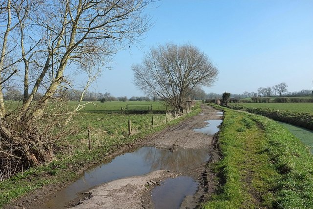
Image: © Derek Harper Taken: 13 Mar 2016
The rhyne in question, on the right, is Nidon Rhyne, which forms the southern boundary of the Somerset Levels; the land slopes up from here to the Polden Hills. The map portrayal of the drove leads one to believe it would be motorable, and, had I had a 4x4 about my person, so it would have been. But I walked.
Images are licensed for reuse under creativecommons.org/licenses/by-sa/2.0
Image Location
Latitude
51.158167
Longitude
-2.858495