Tetney to Hop End, and ridge and furrow: aerial 2016
Introduction
The photograph on this page of Tetney to Hop End, and ridge and furrow: aerial 2016 by Chris as part of the Geograph project.
The Geograph project started in 2005 with the aim of publishing, organising and preserving representative images for every square kilometre of Great Britain, Ireland and the Isle of Man.

There are currently over 7.5m images from over 14,400 individuals and you can help contribute to the project by visiting https://www.geograph.org.uk
Tetney to Hop End, and ridge and furrow: aerial 2016
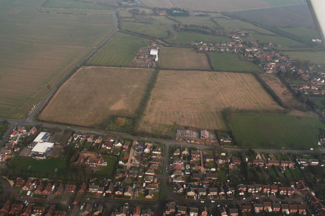
Image: © Chris Taken: 13 Mar 2016
As Tetney succumbs to its first crop of housing to the east of the main road (low centre) it is time to record and reflect on the ancient ridge and furrow fields just behind (centre shot), in case they also are to be surrendered to the developers. There are also some crop marks visible on the field to the left. Hop End top right.
Images are licensed for reuse under creativecommons.org/licenses/by-sa/2.0
Image Location
Latitude
53.492054
Longitude
-0.018442