Demolition of John Ruskin School, Upper Shirley Road, Croydon
Introduction
The photograph on this page of Demolition of John Ruskin School, Upper Shirley Road, Croydon by Dr Neil Clifton as part of the Geograph project.
The Geograph project started in 2005 with the aim of publishing, organising and preserving representative images for every square kilometre of Great Britain, Ireland and the Isle of Man.

There are currently over 7.5m images from over 14,400 individuals and you can help contribute to the project by visiting https://www.geograph.org.uk
Demolition of John Ruskin School, Upper Shirley Road, Croydon
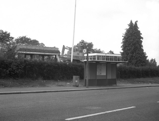
Image: © Dr Neil Clifton Taken: 26 Jul 1993
These school buildings had a very short life. Newly opened in 1954, they then housed a boys' grammar school. This eventually became co-educational and then part of a sixth form college. But the Council decided it could make more money by tearing down the less than fifty year old buildings and selling the land for housing, so in 1993 they were demolished, as seen here.
Images are licensed for reuse under creativecommons.org/licenses/by-sa/2.0
Image Location
Latitude
51.369165
Longitude
-0.054983