Harden Grange
Introduction
The photograph on this page of Harden Grange by Gordon Hatton as part of the Geograph project.
The Geograph project started in 2005 with the aim of publishing, organising and preserving representative images for every square kilometre of Great Britain, Ireland and the Isle of Man.

There are currently over 7.5m images from over 14,400 individuals and you can help contribute to the project by visiting https://www.geograph.org.uk
Harden Grange
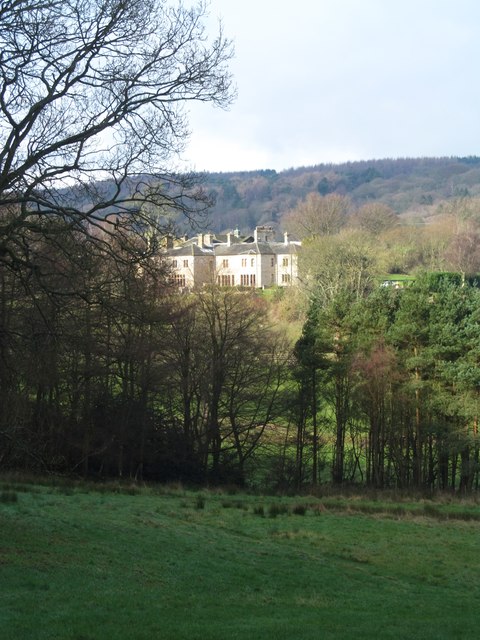
Image: © Gordon Hatton Taken: 11 Feb 2016
Seen from the other side of Harden Beck, one only gets a glimpse of this large house which dates from 1759, although what can be seen from this angle is more likely to be part of the extensive rebuilding by W B Ferrand a hundred years later. The Pevsner guide describes it as 'totally undistinguished architecturally'.
Images are licensed for reuse under creativecommons.org/licenses/by-sa/2.0
Image Location
Latitude
53.840592
Longitude
-1.855438