The Commandery
Introduction
The photograph on this page of The Commandery by Alan Murray-Rust as part of the Geograph project.
The Geograph project started in 2005 with the aim of publishing, organising and preserving representative images for every square kilometre of Great Britain, Ireland and the Isle of Man.

There are currently over 7.5m images from over 14,400 individuals and you can help contribute to the project by visiting https://www.geograph.org.uk
The Commandery
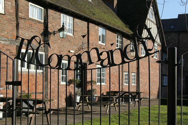
Image: © Alan Murray-Rust Taken: 5 Mar 2016
Cut out lettering on the fence around The Commandery garden. The Commandery was founded in medieval times as a religious hospital and after a variety of uses is now a museum of the Civil War. The buildings date from the 15th to the 19th century and are Listed Grade I.
Images are licensed for reuse under creativecommons.org/licenses/by-sa/2.0
Image Location
Latitude
52.188094
Longitude
-2.217027