Lower Street Stutton
Introduction
The photograph on this page of Lower Street Stutton by Robin Lucas as part of the Geograph project.
The Geograph project started in 2005 with the aim of publishing, organising and preserving representative images for every square kilometre of Great Britain, Ireland and the Isle of Man.

There are currently over 7.5m images from over 14,400 individuals and you can help contribute to the project by visiting https://www.geograph.org.uk
Lower Street Stutton
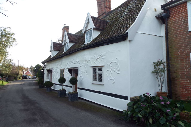
Image: © Robin Lucas Taken: 11 Feb 2016
This building is known as "Ancient House" and is believed to date to the 17th century or earlier. The walls show some decorative pargetting.
Images are licensed for reuse under creativecommons.org/licenses/by-sa/2.0
Image Location
Latitude
51.968105
Longitude
1.131364