Conversion of former Rank-Hovis flour mill, Margate Road
Introduction
The photograph on this page of Conversion of former Rank-Hovis flour mill, Margate Road by John Baker as part of the Geograph project.
The Geograph project started in 2005 with the aim of publishing, organising and preserving representative images for every square kilometre of Great Britain, Ireland and the Isle of Man.

There are currently over 7.5m images from over 14,400 individuals and you can help contribute to the project by visiting https://www.geograph.org.uk
Conversion of former Rank-Hovis flour mill, Margate Road
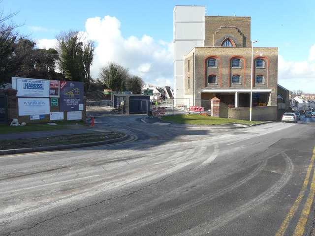
Image: © John Baker Taken: 16 Feb 2016
This view of Image shows it to be in a derelict state. Planning permission has been granted by Thanet District Council under application number F/TH/14/0994 for the “change of use and extension of existing building, erection of two buildings of 3 to 10 storeys and 3 to 6 storeys in height to provide 72 apartments and erection of 17 dwelling houses, following demolition of existing grain silos, wheat feed and machinery buildings, alterations to existing access onto Margate Road and associated parking, land excavation and landscaping without compliance with conditions 2, 6, 10, 11, 16, 19, 20, 21, 27 of planning permission F/TH/11/0288 to allow double glazed steel windows in main mill building, alterations to external design and material including of lift tower extensions, alterations to internal layout and alterations to vehicular access from Margate Road, and amendments to the phasing plan. The council describes the building as Isle Of Thanet Flour Mills. Following its conversion, the building was named Image
Images are licensed for reuse under creativecommons.org/licenses/by-sa/2.0
Image Location
Latitude
51.339892
Longitude
1.413034