Pumping Station, Llandudno Junction
Introduction
The photograph on this page of Pumping Station, Llandudno Junction by Jaggery as part of the Geograph project.
The Geograph project started in 2005 with the aim of publishing, organising and preserving representative images for every square kilometre of Great Britain, Ireland and the Isle of Man.

There are currently over 7.5m images from over 14,400 individuals and you can help contribute to the project by visiting https://www.geograph.org.uk
Pumping Station, Llandudno Junction
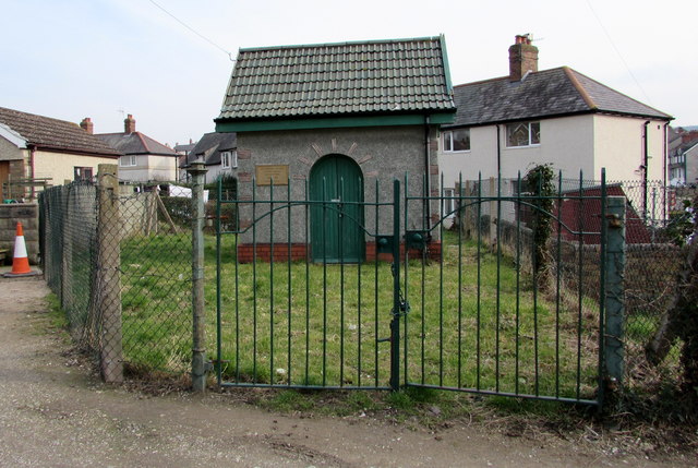
Image: © Jaggery Taken: 27 Feb 2016
Set back 35 metres from the east side of Broad Street. The inscription http://www.geograph.org.uk/photo/4849170 on the rectangular tablet on the wall is BOROUGH OF CONWAY LLANDUDNO JUNCTION SEWERAGE SCHEME 1934-35. PUMPING STATION. http://www.geograph.org.uk/photo/4849174 to a closer view of the building.
Images are licensed for reuse under creativecommons.org/licenses/by-sa/2.0
Image Location
Latitude
53.284787
Longitude
-3.808507