The Manor House
Introduction
The photograph on this page of The Manor House by Ian Capper as part of the Geograph project.
The Geograph project started in 2005 with the aim of publishing, organising and preserving representative images for every square kilometre of Great Britain, Ireland and the Isle of Man.

There are currently over 7.5m images from over 14,400 individuals and you can help contribute to the project by visiting https://www.geograph.org.uk
The Manor House
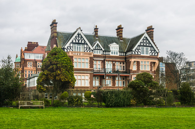
Image: © Ian Capper Taken: 6 Feb 2016
Large house on The Leas built in 1895 for the Earl of Radnor who owned much of the area. In 1986 it was converted into 8 apartments. Grade II listed - see https://www.historicengland.org.uk/listing/the-list/list-entry/1203900.
Images are licensed for reuse under creativecommons.org/licenses/by-sa/2.0
Image Location
Latitude
51.074919
Longitude
1.165397