"Revealing The Roch", The Butts
Introduction
The photograph on this page of "Revealing The Roch", The Butts by David Dixon as part of the Geograph project.
The Geograph project started in 2005 with the aim of publishing, organising and preserving representative images for every square kilometre of Great Britain, Ireland and the Isle of Man.

There are currently over 7.5m images from over 14,400 individuals and you can help contribute to the project by visiting https://www.geograph.org.uk
"Revealing The Roch", The Butts
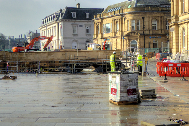
Image: © David Dixon Taken: 24 Feb 2016
The work to uncover the River Roch in Rochdale Town Centre is making good progress. The Revealing the Roch project is uncovering two sections of the river, and will expose the historic bridge, parts of which can be traced back to the medieval period. The bridge and sections of river being exposed (on The Butts in front of the HSBC Bank and on the Esplanade close to Barclays Bank) were covered over in the Victorian period and have been hidden from public view for more than a century.
Images are licensed for reuse under creativecommons.org/licenses/by-sa/2.0
Image Location
Latitude
53.616862
Longitude
-2.157478