Gower Street demolition (1)
Introduction
The photograph on this page of Gower Street demolition (1) by Stephen Craven as part of the Geograph project.
The Geograph project started in 2005 with the aim of publishing, organising and preserving representative images for every square kilometre of Great Britain, Ireland and the Isle of Man.

There are currently over 7.5m images from over 14,400 individuals and you can help contribute to the project by visiting https://www.geograph.org.uk
Gower Street demolition (1)
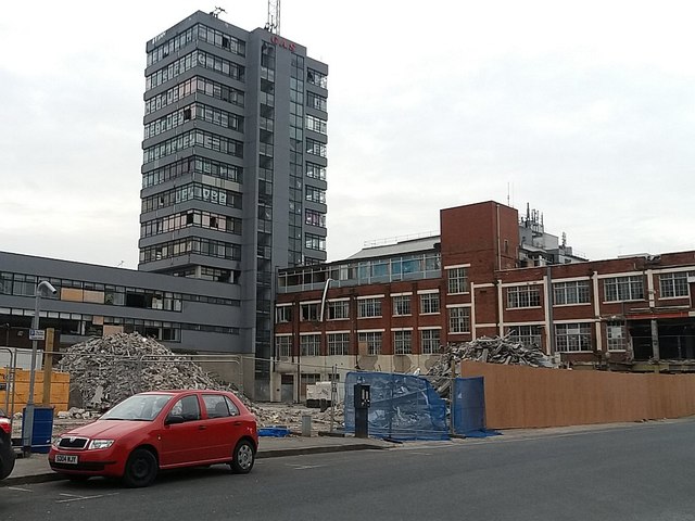
Image: © Stephen Craven Taken: 29 Feb 2016
The buildings on the south side of the street seen to the left of the photo in Image had just been demolished in February 2016. The buildings were still in use when I last passed this way two months earlier in December 2015. It seems that about that time planning permission was granted for redevelopment of the site as mixed use (residential, hotel, health spa). Leeds Council planning application ref. 08/01948/FU.
Images are licensed for reuse under creativecommons.org/licenses/by-sa/2.0
Image Location


Leaflet Map data © OpenStreetMap
Latitude
53.800681
Longitude
-1.535218