Brandsbutt Stone Circle
Introduction
The photograph on this page of Brandsbutt Stone Circle by Anne Burgess as part of the Geograph project.
The Geograph project started in 2005 with the aim of publishing, organising and preserving representative images for every square kilometre of Great Britain, Ireland and the Isle of Man.

There are currently over 7.5m images from over 14,400 individuals and you can help contribute to the project by visiting https://www.geograph.org.uk
Brandsbutt Stone Circle
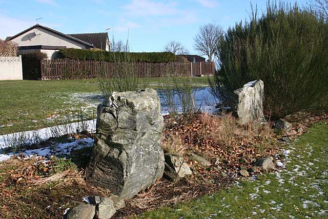
Image: © Anne Burgess Taken: 25 Feb 2016
These two stones, plus the symbol stone a few metres away in the next square, are the remains of a stone circle. According to the 1:25,000 map the nearer one is called the Douping Stone, but I have not found any explanation of this. See https://canmore.org.uk/site/18882/brandsbutt for more information.
Images are licensed for reuse under creativecommons.org/licenses/by-sa/2.0
Image Location
Latitude
57.291575
Longitude
-2.399827