Brandsbutt Stone
Introduction
The photograph on this page of Brandsbutt Stone by Anne Burgess as part of the Geograph project.
The Geograph project started in 2005 with the aim of publishing, organising and preserving representative images for every square kilometre of Great Britain, Ireland and the Isle of Man.

There are currently over 7.5m images from over 14,400 individuals and you can help contribute to the project by visiting https://www.geograph.org.uk
Brandsbutt Stone
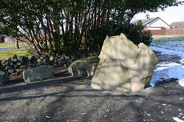
Image: © Anne Burgess Taken: 25 Feb 2016
The Brandsbutt stone bears Pictish carvings and an Ogham inscription. It was found broken into pieces in a field was but has been reassembled. See https://canmore.org.uk/site/18894/brandsbutt-inverurie-symbol-stone for more information.
Images are licensed for reuse under creativecommons.org/licenses/by-sa/2.0
Image Location
Latitude
57.291574
Longitude
-2.399993