Defending Dorset in 1940: the Maiden Newton - Poole Harbour Stop Line (84)
Introduction
The photograph on this page of Defending Dorset in 1940: the Maiden Newton - Poole Harbour Stop Line (84) by Mike Searle as part of the Geograph project.
The Geograph project started in 2005 with the aim of publishing, organising and preserving representative images for every square kilometre of Great Britain, Ireland and the Isle of Man.

There are currently over 7.5m images from over 14,400 individuals and you can help contribute to the project by visiting https://www.geograph.org.uk
Defending Dorset in 1940: the Maiden Newton - Poole Harbour Stop Line (84)
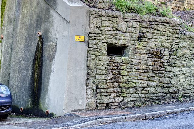
Image: © Mike Searle Taken: 18 Feb 2016
- Pillbox (variant): DoB ID: S0008510 Wareham -St Martin's Church - Square Variant Pillbox. A closer view of this pillbox built into the wall of St Martin's churchyard. The outline of the blocked embrasure in the end wall can be seen to the right of the drainpipe's water stain. Both the railway and the River Frome on their route east along the Stop Line from Maiden Newton towards Poole, part company here. The Frome flows east into Poole Harbour, whilst the railway swings away to the north on its short journey around the harbour to Poole town. Image
Images are licensed for reuse under creativecommons.org/licenses/by-sa/2.0
Image Location


Leaflet Map data © OpenStreetMap
Latitude
50.689167
Longitude
-2.111925