Public footpath off Heol-y-Sheet, nr North Cornelly
Introduction
The photograph on this page of Public footpath off Heol-y-Sheet, nr North Cornelly by eswales as part of the Geograph project.
The Geograph project started in 2005 with the aim of publishing, organising and preserving representative images for every square kilometre of Great Britain, Ireland and the Isle of Man.

There are currently over 7.5m images from over 14,400 individuals and you can help contribute to the project by visiting https://www.geograph.org.uk
Public footpath off Heol-y-Sheet, nr North Cornelly
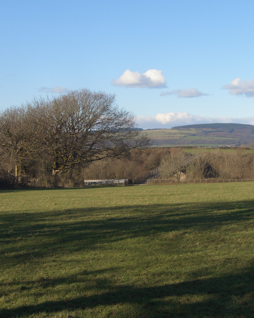
Image: © eswales Taken: 24 Feb 2016
A picture taken at the southern end of a public footpath on the lane Heol-y-Sheet. The path is indistinct on the ground, but Ordnance Survey mapping shows it running directly to a field boundary location more or less where the prominent tree seen in the left of the image is situated. From there, the path passes through the gap in a fence seen beyond and across a bridge over the M4 motorway. The bridge, which can be made out just beyond the gap in the fence, is seen closer up in Image When the photograph was taken, towards the end of a wet winter, the path was very squelchy in places .
Images are licensed for reuse under creativecommons.org/licenses/by-sa/2.0
Image Location
Latitude
51.513987
Longitude
-3.680133