
Defending Dorset in 1940: the Maiden Newton - Poole Harbour Stop Line (75)
Introduction
The photograph on this page of Defending Dorset in 1940: the Maiden Newton - Poole Harbour Stop Line (75) by Mike Searle as part of the Geograph project.
The Geograph project started in 2005 with the aim of publishing, organising and preserving representative images for every square kilometre of Great Britain, Ireland and the Isle of Man.

There are currently over 7.5m images from over 14,400 individuals and you can help contribute to the project by visiting https://www.geograph.org.uk
Defending Dorset in 1940: the Maiden Newton - Poole Harbour Stop Line (75)
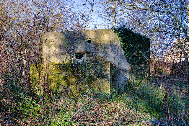
Image: © Mike Searle Taken: 15 Feb 2016
- Pillbox (type FW3/22): DoB ID: e11693 East Stoke - Stokeford - Type 22 Pillbox. This pillbox alongside the main A352 Wool to Wareham road, is strategically located alongside a ruined ammunition store at a road junction, just to the north of the Dorchester to Poole railway and the River Frome. It has a particularly interesting feature that was uncovered in 2010 when members of the PSG set about clearing trees and other encroached vegetation that had surrounded it. The work uncovered evidence that the roof had been provided with the means to break up the outline of the pillbox with a disguise. A hole was uncovered in the centre that could have accommodated a pole from which wires presumably were suspended leading to securing bolts that still survive at each of the six corners. This could have supported a canvas or other covering stretched over the wires to form a conical type "roof". Note the fume vent hole above the embrasure, and the protected entrance. The pillbox appears to have been built entirely of concrete. Image
Images are licensed for reuse under creativecommons.org/licenses/by-sa/2.0
Image Location

Latitude
50.683322
Longitude
-2.182684