Disused railway line at Hirwaun
Introduction
The photograph on this page of Disused railway line at Hirwaun by Alan Bowring as part of the Geograph project.
The Geograph project started in 2005 with the aim of publishing, organising and preserving representative images for every square kilometre of Great Britain, Ireland and the Isle of Man.

There are currently over 7.5m images from over 14,400 individuals and you can help contribute to the project by visiting https://www.geograph.org.uk
Disused railway line at Hirwaun
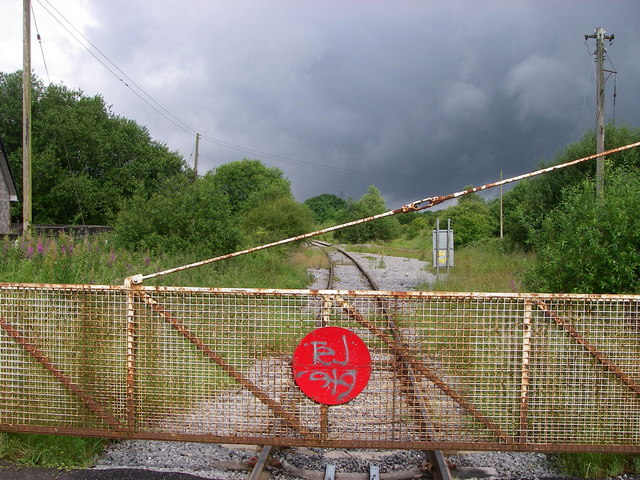
Image: © Alan Bowring Taken: 3 Jul 2007
Vegetation is encroaching on the tracks running from this level crossing at the northern edge of Hirwaun. This spot is right on the boundary of Brecon Beacons National Park which lies to the right (north).
Images are licensed for reuse under creativecommons.org/licenses/by-sa/2.0
Image Location
Latitude
51.743711
Longitude
-3.509757