Site of Dukeries Junction Low Level station, 1992
Introduction
The photograph on this page of Site of Dukeries Junction Low Level station, 1992 by Ben Brooksbank as part of the Geograph project.
The Geograph project started in 2005 with the aim of publishing, organising and preserving representative images for every square kilometre of Great Britain, Ireland and the Isle of Man.

There are currently over 7.5m images from over 14,400 individuals and you can help contribute to the project by visiting https://www.geograph.org.uk
Site of Dukeries Junction Low Level station, 1992
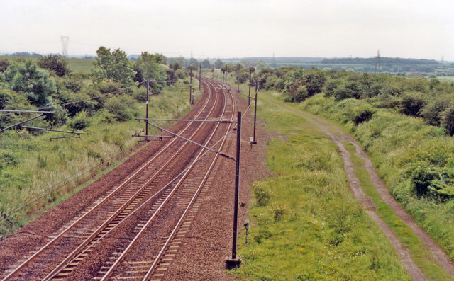
Image: © Ben Brooksbank Taken: 18 Jun 1992
View southward on the ex-GNR East Coast Main Line - recently electrified, towards Grantham, Peterborough and London King's Cross. The view is taken from platform remains of the High Level station on the ex-GCR Lancashire, Derbyshire & East Coast Line (Chesterfield - Lincoln). Both levels of Dukeries Junction station were closed from 6/3/50. Passenger services on the LD&EC line lasted until 19/9/55, but freight (mainly coal) continued right on until 2003; since 8/09 the bridge here has carried the High Marnham Test Track. (See also my Image and Image).
Images are licensed for reuse under creativecommons.org/licenses/by-sa/2.0
Image Location
Latitude
53.224431
Longitude
-0.874779