Jewish Burial Ground, Combe Down
Introduction
The photograph on this page of Jewish Burial Ground, Combe Down by Derek Harper as part of the Geograph project.
The Geograph project started in 2005 with the aim of publishing, organising and preserving representative images for every square kilometre of Great Britain, Ireland and the Isle of Man.

There are currently over 7.5m images from over 14,400 individuals and you can help contribute to the project by visiting https://www.geograph.org.uk
Jewish Burial Ground, Combe Down
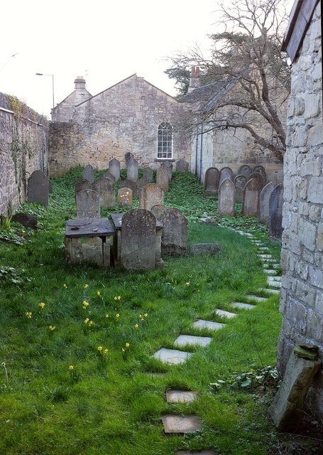
Image: © Derek Harper Taken: 23 Feb 2016
The view to the left of Image], with the wall of the ohel (which dates originally from 1836) on the immediate right. "This is one of only fifteen cemeteries surviving from the Georgian period in the country. The cemetery is notable for the survival of its Ohel(chapel) and the presence of two chest tombs. Despite a prolonged period of neglect since the closure of the cemetery in the early C20, the (approximately) fifty tombstones, walls, gate and Ohel remain essentially intact and the cemetery survives as an important reminder of one of the smaller social minority groups within Bath society" https://historicengland.org.uk/listing/the-list/list-entry/1396344 . Beyond the cemetery is Greendown House, dating from 1806 https://www.historicengland.org.uk/listing/the-list/list-entry/1394946 .
Images are licensed for reuse under creativecommons.org/licenses/by-sa/2.0
Image Location
Latitude
51.359865
Longitude
-2.35326