View from Hoober Stand
Introduction
The photograph on this page of View from Hoober Stand by Stephen Richards as part of the Geograph project.
The Geograph project started in 2005 with the aim of publishing, organising and preserving representative images for every square kilometre of Great Britain, Ireland and the Isle of Man.

There are currently over 7.5m images from over 14,400 individuals and you can help contribute to the project by visiting https://www.geograph.org.uk
View from Hoober Stand
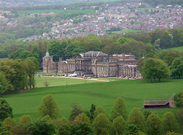
Image: © Stephen Richards Taken: 12 May 2013
From the top of the tower, the Marquis of Rockingham would have been able to survey his vast estate and his monumental home. In reality, two homes as the older red brick house which faces west can be glimpsed on the right.
Images are licensed for reuse under creativecommons.org/licenses/by-sa/2.0
Image Location
Latitude
53.474278
Longitude
-1.404851