Sunderland Riverside at the Ferry Landing
Introduction
The photograph on this page of Sunderland Riverside at the Ferry Landing by Oliver Dixon as part of the Geograph project.
The Geograph project started in 2005 with the aim of publishing, organising and preserving representative images for every square kilometre of Great Britain, Ireland and the Isle of Man.

There are currently over 7.5m images from over 14,400 individuals and you can help contribute to the project by visiting https://www.geograph.org.uk
Sunderland Riverside at the Ferry Landing
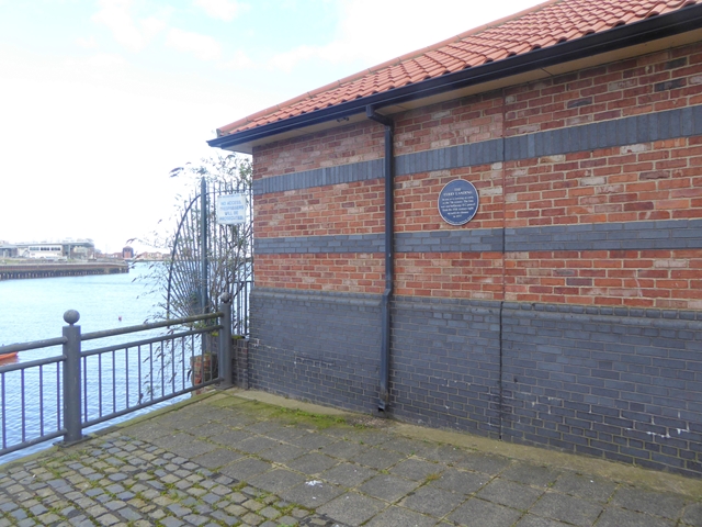
Image: © Oliver Dixon Taken: 23 Feb 2016
This plaque by the south shore of the Wear Estuary (part of the Old Sunderland Heritage Trail) records that this is the site of the Ferry Landing which was in use as a crossing as early as the 7th century. The fare was one old halfpenny from the 18th century right up until its closure in 1957.
Images are licensed for reuse under creativecommons.org/licenses/by-sa/2.0
Image Location
Latitude
54.909422
Longitude
-1.372649