Sandgate Hill
Introduction
The photograph on this page of Sandgate Hill by Ian Capper as part of the Geograph project.
The Geograph project started in 2005 with the aim of publishing, organising and preserving representative images for every square kilometre of Great Britain, Ireland and the Isle of Man.

There are currently over 7.5m images from over 14,400 individuals and you can help contribute to the project by visiting https://www.geograph.org.uk
Sandgate Hill
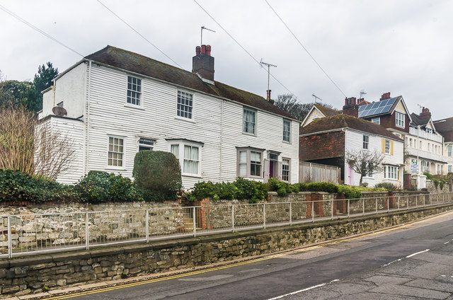
Image: © Ian Capper Taken: 6 Feb 2016
Two weather boarded semi-detached cottages on Sandgate Hill. On the left is Newton Cottage and Rose Cottage, with Barton Cottage and Holly Cottage beyond. All buildings date from the mid 19th Century and are grade II listed - see https://www.historicengland.org.uk/listing/the-list/list-entry/1061177 and https://www.historicengland.org.uk/listing/the-list/list-entry/1204226 respectively.
Images are licensed for reuse under creativecommons.org/licenses/by-sa/2.0
Image Location
Latitude
51.074593
Longitude
1.150496