Washed-out bridleway
Introduction
The photograph on this page of Washed-out bridleway by Jonathan Wilkins as part of the Geograph project.
The Geograph project started in 2005 with the aim of publishing, organising and preserving representative images for every square kilometre of Great Britain, Ireland and the Isle of Man.

There are currently over 7.5m images from over 14,400 individuals and you can help contribute to the project by visiting https://www.geograph.org.uk
Washed-out bridleway
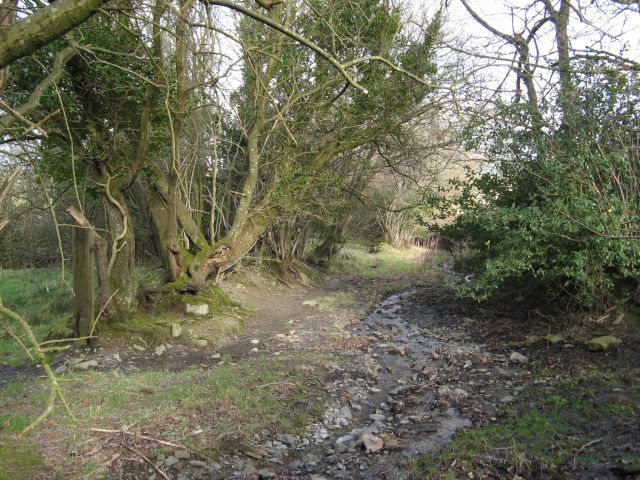
Image: © Jonathan Wilkins Taken: 22 Feb 2016
The sunken lane which is marked as a bridleway has been washed out and claimed as a permanent watercourse near to Nant-gochel, while its abandoned hedges have burgeoned into crooked woodland. A fascinating habitat, but it is a great shame to see traditional routes fall into such disrepair.
Images are licensed for reuse under creativecommons.org/licenses/by-sa/2.0
Image Location


Leaflet Map data © OpenStreetMap
Latitude
53.252794
Longitude
-3.704026