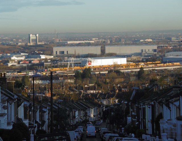
Early morning view down Purrett Road
Introduction
The photograph on this page of Early morning view down Purrett Road by Marathon as part of the Geograph project.
The Geograph project started in 2005 with the aim of publishing, organising and preserving representative images for every square kilometre of Great Britain, Ireland and the Isle of Man.
There are currently over 7.5m images from over 14,400 individuals and you can help contribute to the project by visiting https://www.geograph.org.uk

Image: © Marathon Taken: 19 Feb 2016
Purrett Road drops steeply down from Plumstead Common to Lower Plumstead. In this view, taken not long after sunrise, the Barking Creek Barrier is to the left, the two big grey buildings in the distance are known as 'Iron Mountain' - see http://www.geograph.org.uk/photo/2990467 while in front of these the lines of yellow wagons are within a worksite for Crossrail, situated between Woolwich and the southern terminus at Abbey Wood.

