Linton High Street
Introduction
The photograph on this page of Linton High Street by M H Evans as part of the Geograph project.
The Geograph project started in 2005 with the aim of publishing, organising and preserving representative images for every square kilometre of Great Britain, Ireland and the Isle of Man.

There are currently over 7.5m images from over 14,400 individuals and you can help contribute to the project by visiting https://www.geograph.org.uk
Linton High Street
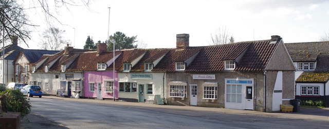
Image: © M H Evans Taken: 18 Feb 2016
These small houses in the village High Street, just west of the river bridge, are now mostly small shops and businesses. Several of the High Street houses are Listed grade II, and a few grade II*, being timber-framed seventeenth century or earlier buildings.
Images are licensed for reuse under creativecommons.org/licenses/by-sa/2.0
Image Location


Leaflet Map data © OpenStreetMap
Latitude
52.097539
Longitude
0.27658