1-14 Trinity Church Square
Introduction
The photograph on this page of 1-14 Trinity Church Square by Stephen Richards as part of the Geograph project.
The Geograph project started in 2005 with the aim of publishing, organising and preserving representative images for every square kilometre of Great Britain, Ireland and the Isle of Man.

There are currently over 7.5m images from over 14,400 individuals and you can help contribute to the project by visiting https://www.geograph.org.uk
1-14 Trinity Church Square
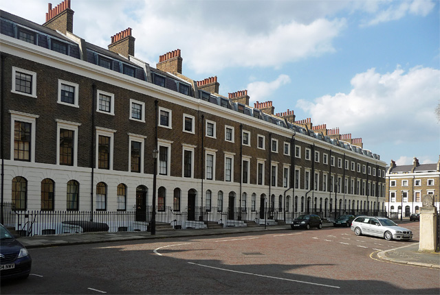
Image: © Stephen Richards Taken: 6 May 2013
The early-mid C19th developments in Trinity Church Square and surrounding streets are very well preserved. The terraces are handsome and uniform, in brick with stuccoed and rusticated ground floors and stuccoed window surrounds. The houses are generally of three storeys plus basements and two bays wide. These, which form the west side of the square, were built c1827. Grade II listed.
Images are licensed for reuse under creativecommons.org/licenses/by-sa/2.0
Image Location
Latitude
51.498591
Longitude
-0.094574