Mendip Houses
Introduction
The photograph on this page of Mendip Houses by Des Blenkinsopp as part of the Geograph project.
The Geograph project started in 2005 with the aim of publishing, organising and preserving representative images for every square kilometre of Great Britain, Ireland and the Isle of Man.

There are currently over 7.5m images from over 14,400 individuals and you can help contribute to the project by visiting https://www.geograph.org.uk
Mendip Houses
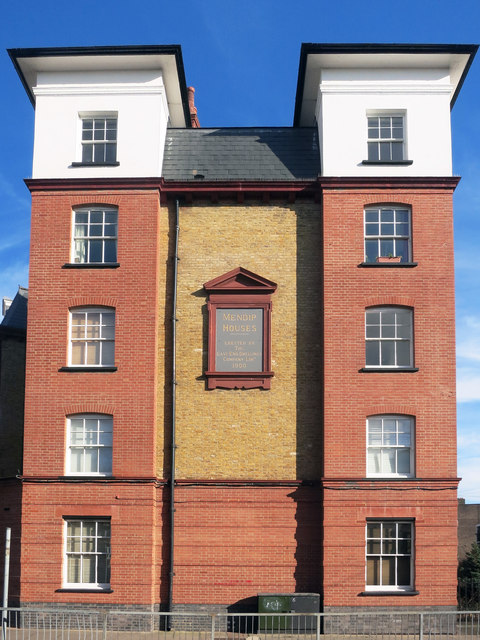
Image: © Des Blenkinsopp Taken: 11 Feb 2016
This 5 storey block was built for The East End Dwellings Company which was set up in 1882 to provide accommodation for local people in an area of great poverty. Another of their developments is just along the road Image
Images are licensed for reuse under creativecommons.org/licenses/by-sa/2.0
Image Location
Latitude
51.528723
Longitude
-0.051218